

Course description
What's on the road
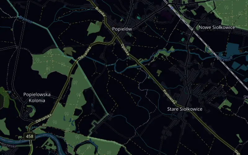
The start is in the transition area by the lake in Nowe Siołkowice. The lead-in along the lakeside road, Polna and Szkolna streets brings you out onto Kupska Street, where the loop begins. After half a kilometre, a turn onto Pokojska and up onto the viaduct over the railway, the highest point of the course. After it, Klapacz and Michała streets to the roundabout in Stare Siołkowice at 3.2 km, then road 457 to Popielów, where at 6 km you turn onto road 458. Through Kobylice the road drops into the Oder floodplain forest, the lowest part of the loop, and leads along an avenue of trees to the turnaround before the bridge over the Oder at 10.1 km. Back along the same road, the roundabout a second time, the viaduct this time from the Klapacz side, and the turnaround on Kupska Street, about a kilometre from the transition area.
What counts is geometry and physics: both turnarounds, the roundabout you take twice and the viaduct over the railway are where they are on the real road, and the gradient goes to your trainer over FTMS. Apart from the viaduct ramps there is no climb to split the group and no descent to rest on, so watts and your position on the bike decide your pace, not your weight. The hardest part is the viaduct on the way back: 7 m up in 250 m near the end of the lap.
- Start in the transition area by the lake in Nowe Siołkowice, a 1.3 km lead-in and a 20.4 km loop: 1/8 IM = 1 lap, 1/4 IM = 2
- The viaduct over the railway twice per lap, 7 m up in 250 m on the way back
- The roundabout in Stare Siołkowice twice, a turnaround before the bridge over the Oder and a turnaround on Kupska Street
- 35 m of climbing per lap, from 142 to 153 m above sea level
Triathlon Opolski in the Liga Triathlonu calendar · See the Polish race courses in the catalogue