
Course description
What's on the road
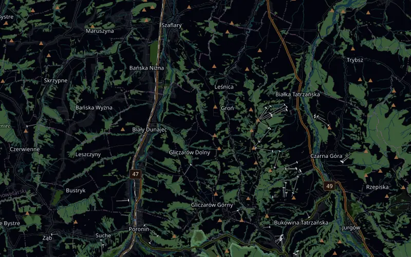
From the start line the road drops straight away towards Groń. Before the valley there are two shorter climbs, from 7.3 km with 70 m of climbing and from 11.1 km with 65 m, and a sprint segment at 15.2 km. At 16.3 km the longest climb of the loop begins: over 300 m up through Biały Dunajec and Gliczarów, and at km 20 the Wall, briefly up to 21%. The last kilometres run across the plateau back to the start line.
What counts is geometry and physics: every bend, climb and descent is where it is on the real road, and the gradient goes to your trainer over FTMS. Speed is calculated from power and the weight of rider and bike, so on the Wall and the whole last climb watts per kilogram count, and on the descents your position on the bike.
- 24 km loop with start and finish on Wierch Olczański in Bukowina Tatrzańska, amateur race = 2 laps
- Descent to Groń, through Leśnica and Szaflary, two shorter climbs and a sprint at 15.2 km
- From 16.3 km over 300 m of climbing through Biały Dunajec and Gliczarów, the Wall briefly up to 21%
- 529 m of climbing per lap, from 647 to 994 m above sea level